
The Choctawhatchee River basin stretches across a broad swath of southeastern Alabama and northwestern Florida, carving through longleaf pine flatwoods, bottomland hardwoods, and open wetlands that few regions in the American South can match. For residents of Newton, Alabama and the surrounding Dale County communities, this river system sits practically at the doorstep — offering a remarkable range of outdoor experiences without requiring a long drive or expensive gear.
Understanding what the basin offers, and how to engage with it responsibly, helps locals and visitors alike make the most of one of South Alabama’s most ecologically significant natural corridors.
The River Basin and Why It Matters to South Alabama
The Choctawhatchee River originates in southeastern Alabama near Geneva County and flows roughly 140 miles southward before emptying into Choctawhatchee Bay on the Florida Panhandle. The basin — the entire watershed that drains into the river — covers approximately 4,600 square miles and includes portions of Dale, Geneva, Houston, and Barbour counties in Alabama.
The river system is a designated aquatic biodiversity hotspot. Researchers and conservation organizations identify the Mobile-Tensaw and Choctawhatchee drainages as among the most species-rich freshwater systems in North America, supporting a dense concentration of native mussels, fish, and amphibians. For Newton-area residents, proximity to this watershed is both an ecological privilege and an outdoor recreation asset.
The basin’s health also directly affects local water quality, flood behavior, and storm drainage across Dale County — making it relevant far beyond recreational interest. As Newton’s town center has evolved, community connections to the surrounding natural landscape have remained a defining part of the area’s identity.

Paddling and Water-Based Recreation
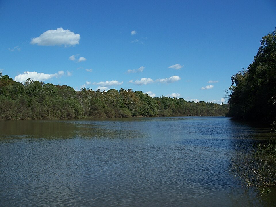
Canoeing and kayaking rank among the most accessible entry points into the Choctawhatchee basin. The river’s pace is generally moderate, with stretches suited to beginners as well as longer sections with stronger currents that challenge more experienced paddlers. Several public water access points exist along Alabama Highway 167 and near the Geneva County line, giving Newton-area residents manageable launch options without requiring a guided outfitter.
The upper reaches of the Choctawhatchee near Newton tend to run faster and narrower during winter and spring, when Alabama’s rainfall peaks. The U.S. Geological Survey’s streamflow data tracks real-time river gauge readings across the basin, which paddlers use to assess water levels and current speed before heading out. High-water periods following heavy rain events — common in South Alabama’s subtropical climate — raise the river significantly and alter navigation conditions.
Fishing along the basin draws anglers year-round. The river supports populations of largemouth bass, bluegill, redear sunfish, and several catfish species, along with the occasional striped bass in lower reaches. The Alabama Department of Conservation and Natural Resources licenses freshwater fishing activity in the basin and publishes seasonal regulation updates for Dale and Geneva counties.
Hiking and Trail Access Near the Basin
While the Choctawhatchee basin itself lacks a large developed trail network on the Alabama side, several natural areas within reasonable distance of Newton provide land-based access to basin-adjacent ecosystems. The Conecuh National Forest, located roughly 45 miles to the west, preserves one of the last significant remnants of longleaf pine savanna in the Southeast and offers more than 20 miles of designated hiking trails, including the Conecuh Trail — a point-to-point route that passes through pitcher plant bogs and open wire grass understory.
Closer to Newton, the river floodplain itself provides informal hiking and nature observation opportunities along elevated ridgelines above the bottomland forest. Birding is especially productive during spring and fall migration periods, when the river corridor serves as a flyway for neotropical songbirds moving between South America and their northern breeding grounds.
Wildlife Observation and Natural History
The Choctawhatchee basin supports an exceptional diversity of wildlife, in part because of the variety of habitats it contains within a relatively compact geographic area. River swamps, oxbow lakes — crescent-shaped water bodies formed when a river meander is cut off from the main channel — upland pine forest, and open sandbars each host distinct communities of species.
Reptiles are particularly well represented. The basin provides habitat for several turtle species, including the Alabama map turtle, a species with a restricted range centered on rivers in this part of the state. The U.S. Fish and Wildlife Service maintains species distribution records for several basin-dependent animals with formal conservation status, and the agency’s wetlands mapper documents protected wetland areas within Dale and Geneva counties.
White-tailed deer, river otter, beaver, and wood duck are commonly observed by those spending extended time near the water. Early morning hours — particularly in fall and early winter — offer the best conditions for wildlife observation before human activity increases along access points.

Seasonal Conditions and What to Expect
South Alabama’s climate shapes outdoor activity in the basin significantly across the calendar year. Summers are hot and humid, with daytime temperatures regularly exceeding 90°F and high moisture content that intensifies heat exposure. Mosquitoes and biting insects peak between May and September, making insect protection essential for any extended time in bottomland or floodplain areas.
Spring offers the most dynamic conditions for paddling and fishing, as water levels rise with seasonal rainfall and fish activity increases with warming temperatures. Fall brings cooler air, reduced insect pressure, and the annual migration spectacle through the river corridor. Winter, though mild by national standards, can produce cold snaps that temporarily suppress fish activity and require appropriate layering for comfortable outdoor time.
Flash flooding is a real seasonal hazard. The Choctawhatchee basin drains a large area, and heavy upstream rainfall in Dale or Geneva counties can raise river levels rapidly — sometimes within hours. Checking National Weather Service forecasts and USGS gauge data before any water-based outing is a straightforward and important precaution for anyone recreating near Newton.
Awareness of local geography matters here, and the growth around Dale County schools reflects how deeply rooted families in this region are in understanding the land around them.