The Pea River winds quietly through southeastern Alabama, shaping landscapes, livelihoods, and communities along its path. As a tributary of the Choctawhatchee River, it flows through rural countryside, pine forests, and agricultural land, connecting a collection of small towns whose identities have been shaped by geography and history. These communities reflect a distinctly South Alabama character—grounded in agriculture, civic tradition, and long-standing ties to the land.
Exploring the Pea River region offers insight into how natural waterways influence settlement patterns, economic development, and community life across generations.
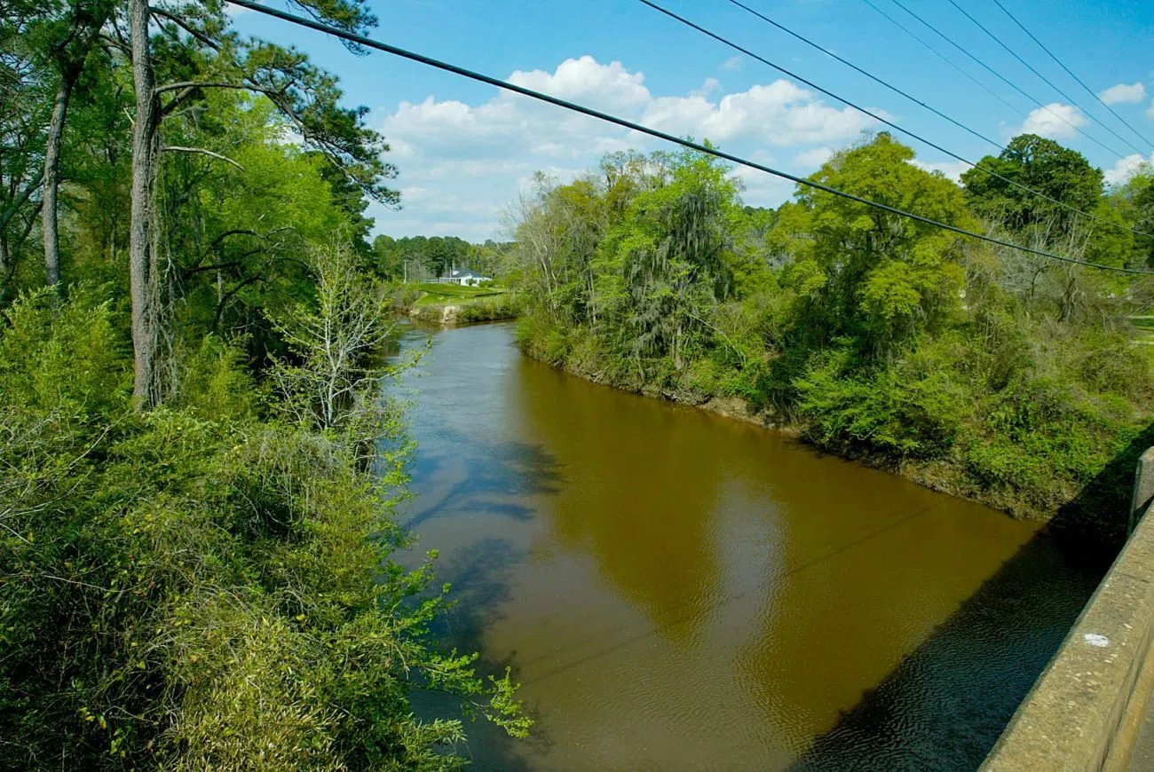
The Pea River as a Regional Lifeline
Originating in Bullock County, Alabama, the Pea River travels south through Pike, Coffee, Dale, and Geneva counties before crossing into Florida. Historically, the river supported early settlement by providing water for crops, livestock, and small industries such as gristmills and timber operations. River crossings also influenced where towns developed, often becoming focal points for trade and transportation.
Today, the Pea River remains environmentally significant. Portions of the watershed support wetlands, floodplains, and forested habitats that are protected through conservation programs. Public access areas near the river encourage outdoor activities such as canoeing, fishing, and wildlife observation, reinforcing the river’s continued relevance to daily life in the region.
Enterprise: A Regional Center with Agricultural Roots
Located near the Pea River basin in Coffee County, Enterprise serves as one of the region’s primary commercial and civic centers. Its growth accelerated in the early 20th century alongside the agricultural economy, particularly peanut farming. The town’s historic downtown reflects this era, with preserved buildings that illustrate early commercial development in South Alabama.
Enterprise continues to function as a gathering point for surrounding rural communities, hosting events, markets, and civic activities that draw residents from across the Pea River region. Its role highlights how small towns can serve broader regional functions while maintaining local identity.
Elba: A Town Shaped by the River
Elba sits directly along the Pea River and has one of the strongest physical and historical connections to the waterway. Founded in the 19th century, Elba developed around river access, later incorporating rail lines and road networks that expanded its reach. The town’s historic structures—including civic buildings and residential neighborhoods—reflect multiple phases of development tied to regional trade.
Flooding has played a significant role in Elba’s history, shaping infrastructure decisions and land use planning. These events remain part of the town’s collective memory and underscore the long-standing relationship between river communities and natural forces.
Ozark and Daleville: Regional Links Beyond the Riverbank
While not located directly on the Pea River, Ozark and Daleville remain closely tied to the region through shared economic, transportation, and social networks. Ozark, the seat of Dale County, has long served as an administrative and civic center, while Daleville’s development reflects the influence of nearby military installations.
Together, these towns illustrate how the Pea River region extends beyond the river itself, forming a network of interconnected communities shaped by geography and regional planning.

Geneva and Southern Pea River Communities
As the Pea River approaches the Florida state line, towns in Geneva County reflect a more rural character rooted in agriculture and forestry. The town of Geneva developed as a local trading center, supported by fertile farmland and proximity to the river. These southern communities often emphasize outdoor recreation, land stewardship, and multigenerational ties to farming and timber industries.
Seasonal river conditions continue to influence life in this part of the region, reinforcing the Pea River’s role as both a natural asset and a defining geographic feature.
Architecture, Land Use, and Community Continuity
Across the Pea River region, architecture reflects practicality and adaptation to climate. Farmhouses, early commercial buildings, and civic structures emphasize durability and function. Land use patterns reveal the historical importance of crops such as peanuts and cotton, as well as timber production, which remains a significant industry in parts of South Alabama.
Despite economic changes, many towns maintain continuity through shared institutions such as schools, churches, and local events. These elements help preserve community identity while allowing gradual growth and adaptation.
The Pea River Region Today
Today, the Pea River region balances tradition with incremental change. Infrastructure improvements, conservation initiatives, and regional cooperation have strengthened connections among towns while preserving their individual character. The river itself remains a unifying element—linking communities through shared history, environment, and cultural memory.
For those seeking to understand South Alabama beyond major cities, the Pea River region offers a meaningful example of how small towns endure and evolve alongside the landscapes that define them.